


SITE UNDER RECONSTRUCTION. NO HARD HATS AVAILABLE.
I’LL LAUNCH A PARTY WHEN ITS READY!
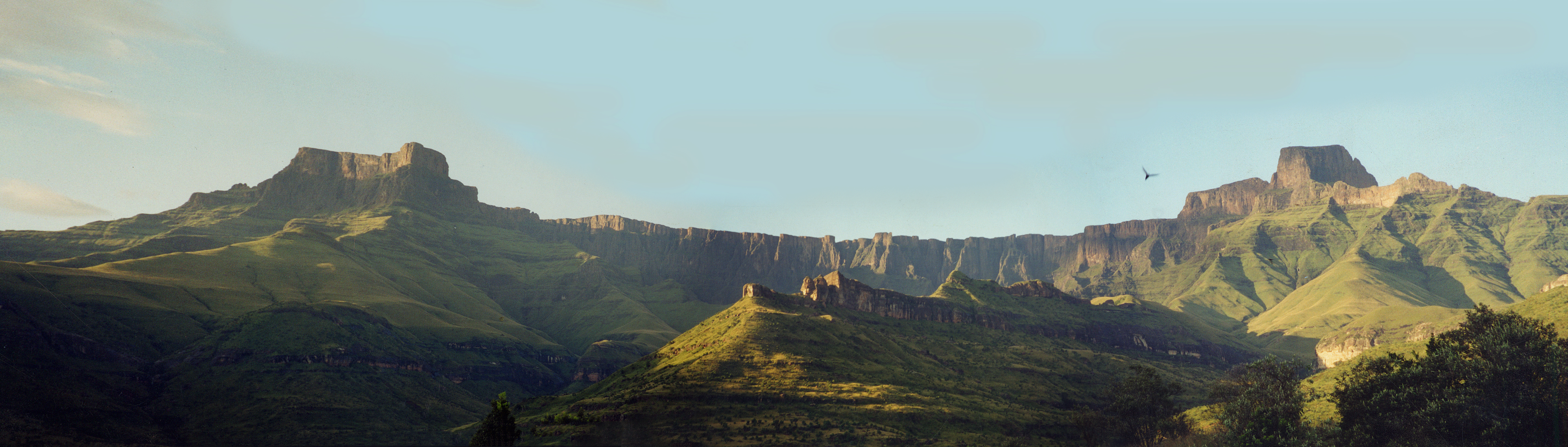
Many people have asked about the photograph in the Header. This was taken in early morning in 2000, and it is of the spectacular Amphitheatre in the northern Drakensberg not far from my family’s farm in the Freestate (where I was born). This cliff face is three times the size of all the cliff faces in the Yosemite Park, rising 10.000 feet above sea level and 4000 above the base. The buttress on the left is called the Mont aux Sources since it gives rise to many rivers, notably the Tugela, flowing east, but also via its tributary (The Caledon) to the Orange flowing west, and via the Elands to the Vaal flowing North. It stands sentinel as the very navel of the country and its arteries. The walk up the Tugela towards the summit is through narrow passes overshadowed by trees and calling monkeys, and ever the bubbling water…
As a child I rode through this country in my holidays with saddlebags, picnics and plunging in cold pools. Its call is everlasting , and gets stronger now I know I shall never see
 it again.


